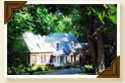
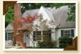
Reynolda Road
 Reynolda Road (Highway 67) has for many years been the main route from
downtown Winston-Salem to the surrounding communities to the northwest. It
is named after the Reynolds family whose country estate located a few miles
from downtown.
Reynolda Road (Highway 67) has for many years been the main route from
downtown Winston-Salem to the surrounding communities to the northwest. It
is named after the Reynolds family whose country estate located a few miles
from downtown.
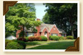
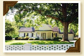
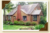
Many other wealthy families settled near this area as well. Families such as the Grays, Hanes, Davises and the Hines all moved to this area to build their country estates. Also, the infamous Dr. Speas, MD, and Dr. Cox, Chiropractor, both settled near the intersection of Reynolda Road and Polo Road. Clyde Myers, Carl Barnes, the Baitys and the Hennings were some of the other residents.
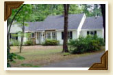
Polo Road
 Polo
Road, named for the polo field, next to Speas Elementary School, runs west and
east from Robinhood Road to Indiana Avenue. It was
a dirt road until the mid 1930's. The section of Polo Road between Reynolda Road and
University Parkway (formerly Bethabara Road) is the main corridor of the Oak Crest neighborhood. At
one time it was called Oak Crest Drive.
Polo
Road, named for the polo field, next to Speas Elementary School, runs west and
east from Robinhood Road to Indiana Avenue. It was
a dirt road until the mid 1930's. The section of Polo Road between Reynolda Road and
University Parkway (formerly Bethabara Road) is the main corridor of the Oak Crest neighborhood. At
one time it was called Oak Crest Drive.
 |
 |
 |
 Freds
Road is a short street off Friendship Circle. It is named after
Fred Nesbit who was the son of John and Rebecca Nesbit. The Nesbit family
own much of the property along Freds Road.
Freds
Road is a short street off Friendship Circle. It is named after
Fred Nesbit who was the son of John and Rebecca Nesbit. The Nesbit family
own much of the property along Freds Road.
Crepe Myrtle Circle
 Crepe
Myrtle Circle was a tract of land owned by H.A. Nading. He
designed the circle and planted the crepe myrtle trees that line the street
today. His daughter, Mary McGeehee, is in her mid-nineties and, until
recently, still lived on
the street that her father designed.
Crepe
Myrtle Circle was a tract of land owned by H.A. Nading. He
designed the circle and planted the crepe myrtle trees that line the street
today. His daughter, Mary McGeehee, is in her mid-nineties and, until
recently, still lived on
the street that her father designed.
 |
 |
 |
Harmon Avenue
 Harmon
Avenue is a short street that was originally a boulevard. It had a center
median with grass and trees. When the residents requested that the street be
paved, the city would only agree to pave one side of it. So, they took up
the median and paved that area, giving the residents on each side of the
street the portion of the old boulevard as an extended front yard. The
evidence of the old road is still present as curbs, walls, and sidewalks
stop short of the present street.
Harmon
Avenue is a short street that was originally a boulevard. It had a center
median with grass and trees. When the residents requested that the street be
paved, the city would only agree to pave one side of it. So, they took up
the median and paved that area, giving the residents on each side of the
street the portion of the old boulevard as an extended front yard. The
evidence of the old road is still present as curbs, walls, and sidewalks
stop short of the present street.
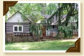
Harmon got its name for the Harmon sisters who lived in a cabin on a small farm, which is now part of nearby Woodberry Forest.
 It is said that the Harmon sisters
were responsible for the name Oak
Crest. The Davis family who lived on Sunnynoll Farm (corner of Reynolda Road and
Polo Road) would send their children to deliver fresh fruits and vegetables to the
Harmon sisters. The children would carry the fresh goods on a cart pulled by
a pony named Toby. They would go through the fields of Sunnynoll and a
forest of beautiful oak trees, down a steep hill on the south side of Crepe
Myrtle Circle to the Harmon’s little cabin. The children called the steep
hill “whoopee hill” because as they went down the hill
they would all yell “whoopee”. Since the
crest of the hill contained oak trees, the Harmon sisters called the area “Oak Crest”.
It is said that the Harmon sisters
were responsible for the name Oak
Crest. The Davis family who lived on Sunnynoll Farm (corner of Reynolda Road and
Polo Road) would send their children to deliver fresh fruits and vegetables to the
Harmon sisters. The children would carry the fresh goods on a cart pulled by
a pony named Toby. They would go through the fields of Sunnynoll and a
forest of beautiful oak trees, down a steep hill on the south side of Crepe
Myrtle Circle to the Harmon’s little cabin. The children called the steep
hill “whoopee hill” because as they went down the hill
they would all yell “whoopee”. Since the
crest of the hill contained oak trees, the Harmon sisters called the area “Oak Crest”.
Hobart Street
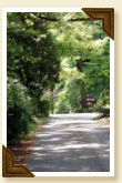 Hobart
Street is a small connector street between Harmon Avenue and Rosedale Circle.
Some of the old maps have it labeled “Rosedale Jr”. It is only wide enough
for one car and is surrounded by beautiful trees. It’s like driving trough a
tunnel. Originally tar and gravel, the street was paved in the 1970’s. It was
scheduled to be resurfaced a few years ago, but the city has a policy that
it must be wide enough for two cars to meet, which would mean cutting down
those beautiful trees. The residents requested it be left alone.
Hobart
Street is a small connector street between Harmon Avenue and Rosedale Circle.
Some of the old maps have it labeled “Rosedale Jr”. It is only wide enough
for one car and is surrounded by beautiful trees. It’s like driving trough a
tunnel. Originally tar and gravel, the street was paved in the 1970’s. It was
scheduled to be resurfaced a few years ago, but the city has a policy that
it must be wide enough for two cars to meet, which would mean cutting down
those beautiful trees. The residents requested it be left alone.
 |
 |
 |
|
|
||
Oak Crest Residential Area Map
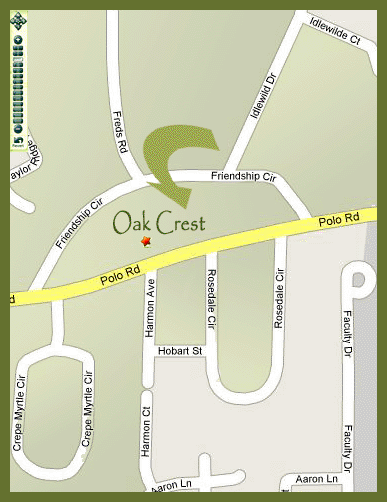
[ For Larger View, Click On Image ]
|
|
|
|
|
Click here
to take a leisurely online stroll through the Oak Crest neighborhood. |
![]()